.jpg)
Location of EME stations
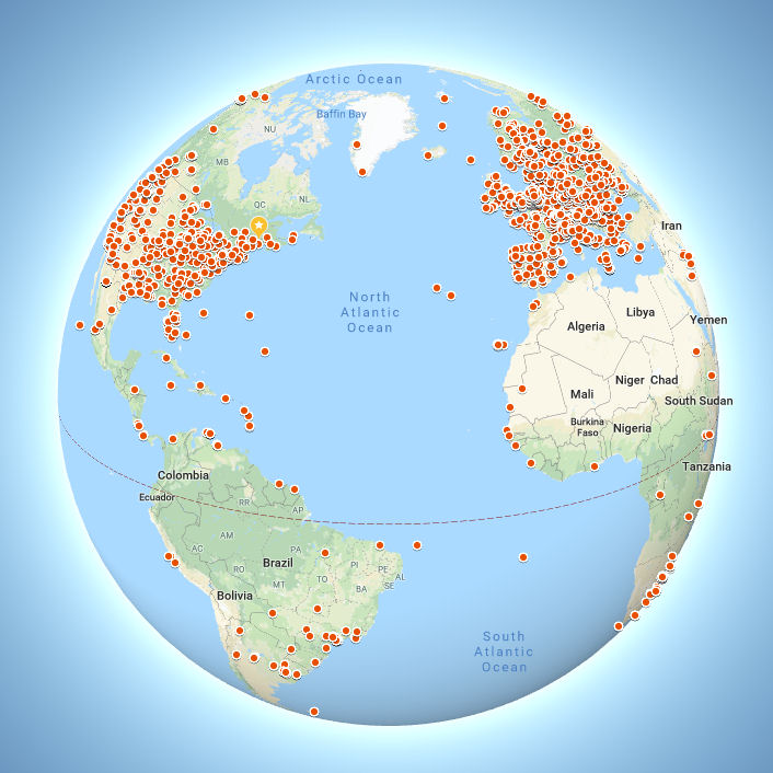
UPDATE - January 2026
Below is the APPROXIMATE location of 23cm EME stations as of January 2026, based on those stations entering their details on the HB9Q logger. It is NOT a GPS map of your station location. Errors in the data entered will be reflected by errors on the map. Not all stations may be active. The data for stations no longer active (or SK) may not have been removed. I believe there are 1496 stations shown on this map.
The following stations might want to check the formatting of their Grid square information: G6CUT, JG7PEF,KD2OMA,KT1R,ON7ZO,RN1NW,RW9OG,VA6EME,VR2WAZ,W3OKU,WB8LGA,XE1GCR. Errors such as mixing up O ("oh") and 0 (zero), having spaces in the wrong place (leading space or space between characters, having only 5 characters (must be 4 or 6) all generate issues (when converting to lat/long coordinates). Stations which appear to be in the middle of the ocean may be on small islands (sometimes Dxpeditions)- if you zoom in you may see land)- or they may be due to incorrect grid information. For a properly configured 6 character grid, the dot on the map should be within 5km (3m) of the actual location. 4 character Grid locators only get you to within 100km (62m) of the true location.
NOTE that if you zoom in the marker will almost certainly NOT be the actual, GPS accurate, location of your station for a number of reasons. First, even a 6 digit grid locator only defines a position on the earth that will be somewhere thats up to 5km from your actual location. GPS can be good to a few meters. This isn't GPS. Second the locations are dithered slightly so that two stations with exactly the same 6 digit grid (or 4 digit grid) do not lie exactly on top of each other. If they did then Google Maps would show only one of the stations. The dithering and limited resolution locator is inconsequential as far as EME and Doppler calculation is concerned, at least for 23cm. It will however prevent people from finding your house and targeting you with GPS guided weapons...
So more accurately speaking, the map shows a marker somewhere in the grids in which there are 23cm EME stations. If you have a 4 character grid in the HB9Q database, you might want to change that to 6 digits. It won't affect this edition of the map, but it will when the map data is updated. If you see a dense cluster of stations, it's probably because they all used the same 4 character grid (like FN20) and the dithering algorithm has spread the locations out slightly, so that all the stations are visible near the center of that grid. With a 4 character locator, all you know is that the station is somewhere within about 100km of where the pin is on the map.
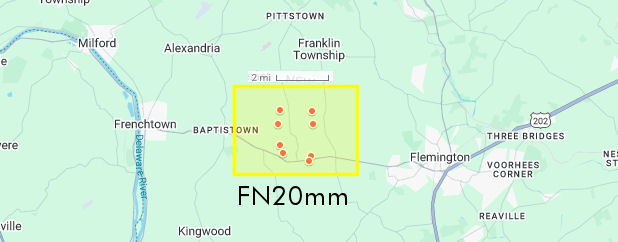
Below is what you would see in the center of the FN20 grid square FN20mm (which is at the center of FN20) is shown in yellow. Even the 6 character FN20mm only specifies that the station will be located somewhere in the central yellow box. Just "FN20" means the station is somewhere in Central New Jersey of Eastern Pennsylvania, even though it will be displayed in the central FN20mm grid square on the map. I believe all 8 stations shown just use FN20 as their grid in the HB9Q database. There is an excellent, zoomable, map at https://www.m0ahn.co.uk/interactivelocatormap.html which shows the area covered by 2, 4, 6 and 8 character locators.
Having read and hopefully understood all this, here is the 23cm station (grid) location Map for January 2026
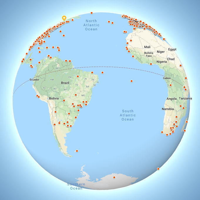
Below is a 1296 EME station map based on data from PA0PLY's EME directory and the HB9Q logger as of August 2024. Enlarge it for a better view and better control. Click on the square at upper right of map. Thanks to Jan and Dan for providing me with 1296 station data for this project.
I have not attempted to edit the databases for errors, therefore:
Note that some stations only have a 4 character Grid location, in which case they are shown in the center of that large grid. Stations with a 6 character Grid locator are shown in the center of that smaller grid. This means that if you expand the map down to the street level, the exact position of the station will not coincide with the position on the map. For that you would need 8 character Grid locators (or better). Also, there may be errors in the database due to typo in station submissions. Stations which appear to be on no visible land presumably have an error in the grid data (or were Dxpeditions to reefs or rocks not shown on the Google Map).
Not all stations shown may be active. The problem with all directories is that while stations may enter their info when they are on the band, they do not remove it when their station is no longer active.
Not all active stations are present in this EME directories. I'm working to including data from other sources in a future update. There is no single, definitive, 1296 EME directory with no errors, all stations and only active stations. If there was, it would probably be out of date by next week anyway. I hope to include data from HB9Q in the future.
From the same data set, here is a plot of dish size vs. station number when stations are ranked by dish size. The most common dish size (median) is 3m and the average dish size (for dishes < 10m in diameter) is 3.5m. You could say that the average dish size of a station on 1296MHz EME is 3m.
The earlier page
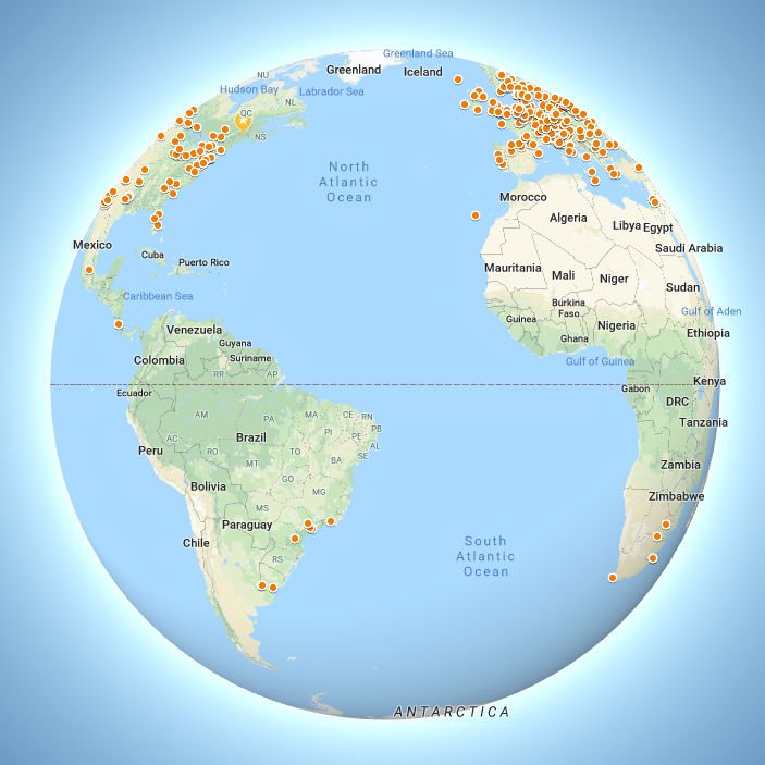
Below is a first attempt at a map of EME stations. The basic data was extracted from the call3.txt file used with WSJT. This file contains entries for silent key, inactive stations, one time expeditions etc. so a mark on the map doesn't always indicate an active station. Only stations that are listed in the call3.txt file as EME active/capable and have a 6 character grid locator are shown.To repeat, GIGO, or in other words, "inaccurate/old data in, inaccurate/old data out". The call3.txt file contains a lot of accurate listings but not 100% of the listings are both accurate and represent an actual current EME station. If you are an active EME station and you are nor shown, all that means is that you were not listed in the version of call3.txt I used to make this map. I will be repeating the process with a more complete file when I find one. This is just a test.
If you fully zoom in on the image, the location you will see the red dot is the center of the locator grid in which the station is situated, not at the exact location of the station. Six character locator coordinates don't specify location precisely enough to identify your house!
If you are on EME and you are not listed here, you can create an entry in the mmmonvhf.de database. One you've registered and logged into the site you can create a VHF database entry at http://mmmonvhf.de/dbase.php. Any entry which lists EME, MS or WSJT as and activity is automatically added to their daily updated version of call3.txt. If you are already registered there and you're not on the map above, make sure you have EME as one of your listed activities.
Call3.txt is an non-curate file designed for use with WSJT. No-one really "maintains" it and there are many versions of it around. It's not a definitive list of all EME active stations and it's not any kind of "official" EME directory. MMMONVHF generates a copy daily from their VHF database. It contains details of stations who are, or have been, active on VHF and up bands using weak signal modes (i.e. no FM repeater operators). Weak signal modes include MS, Aurora, EME, WSJT, CW, SSB etc.
Here's an EME map based on at PA0PLY's database at www.pa0ply.nl. Not all the entries in that database have been plotted here since some lack locator information. Only 432 stations are shown at the moment.
The map can provide a quick check on database numbers. For example I don't think KG7HF is in the Atlantic ocean, 80 miles east of Portland, Maine!
Here's a first try at a 1296 EME map
Moon at +21 degrees declination (call3 stations)
Moon at -21 degrees declination (call3 stations)
Moom at zero degrees declination (1296 stations)
Useful Links: